|
|
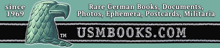
This is an undated, two-sided Third Reich map of Pommern (Pomerania) on the southern shore of the Baltic Sea. The map includes the strategically important port cities of Stettin and Swinemunde, as well as places like Pasewalk, Prenzlau and sea side resorts like Stolp and Kolberg, now part of Poland.
The Peenemünde area, site of Heeresversuchsanstalt Peenemünde, the Nazi Army Research Center is also on this map. Several German guided missiles and rockets were developed and tested here before and during World War II, including the V-2 rocket.
The Peenemünde area, site of Heeresversuchsanstalt Peenemünde, the Nazi Army Research Center is also on this map. Several German guided missiles and rockets were developed and tested here before and during World War II, including the V-2 rocket.
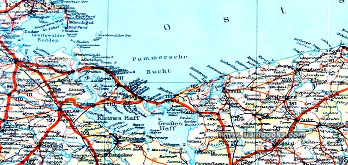
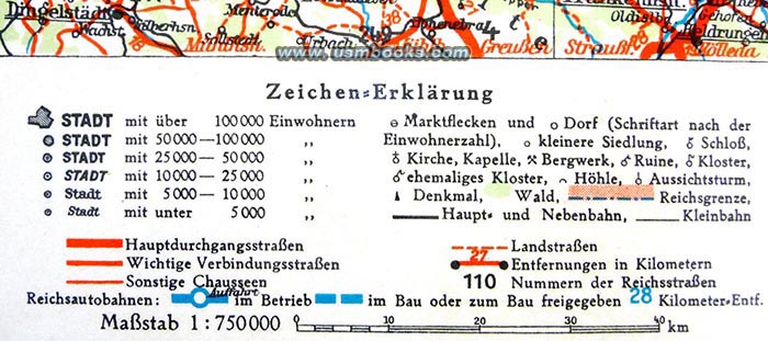
Unfolded the map measures 11-¼ x 14-¼ inches and the underlined cities on the color map have BP-Olex Tankstellen or gas stations. The BP-Olex Autokarte Pommern shows Reichsautobahn sections in use and still under construction, highways and country roads, cities and towns big and small, castles, monasteries, mines, monuments, scenic views, etc.
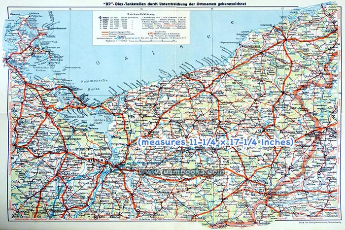
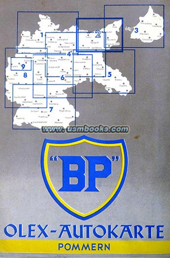
The reverse side includes a city map of Stettin (now Szczecin, Poland) as well as Usedom which includes the area between Swinemünde and Zinnowitz. There are illustrations of important traffic signs and advertising for BP oil products. The color map was produced by Georg Westermann of Braunschweig and the scale is 1 : 750,000.
The reverse side includes a city map of Stettin (now Szczecin, Poland) as well as Usedom which includes the area between Swinemünde and Zinnowitz. There are illustrations of important traffic signs and advertising for BP oil products. The color map was produced by Georg Westermann of Braunschweig and the scale is 1 : 750,000.
The map is not dated but probably dates to 1937 or 1938 because of the sections of the Nazi freeway network that are shown as completed and still under construction. The Reichsautobahn between Berlin and Stettin was officially inaugurated by Hermann Göring and Generalinspektor für das deutsche Strassenwesen Dr. Fritz Todt (in Goering’s Mercedes roadster) in September 1936, and is shown as finished on this map. The section east of the Oder river from Stettin is still a dotted blue line meaning it was under construction. The planned Reichsautobahn that was to connect Berlin with the city of Königsberg in East Prussia (now Kaliningrad) was never finished.
The original 85+ year old Third Reich German BP map of Pomerania was carefully laminated by a previous owner. It was in very good condition when it was laminated - no writing, no tape, no tears. We lightened some of the pictures used on this USMBOOKS web page for clarity and readability, the actual map is somewhat more ivory colored than it appears in our photos.
Have a look at other original Third Reich civilian and military maps for sale on USMBOOKS.com. We are happy to combine shipping of multiple purchases!
for $49.95 delivered by USPS Ground Advantage in the continental USA. |
| • IF you prefer faster and safer Priority Mail shipping with USPS Tracking add $8.95. |
| • IF you wish to purchase highly recommended, but optional insurance, add $3.50. |
| • We will be happy to ship abroad at additional cost, however foreign customers are responsible for any VAT payments, import duties and clearing fees. Please inquire. |
PRE-WAR THIRD REICH BP COLOR ROAD MAP OF POMERANIA |
BP-OLEX AUTOKARTE POMMERN